Precise data & geospatial services are an essential requirement for many different industries in the public & private sectors.
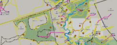
Surveying & Mapping
Using advanced technologies, Bosys provides accurate and economical products more efficiently compared to traditional methods. High-resolution orthomosaics and point clouds are created from aerial data and used to produce high-accuracy maps, and to digitize features such as fire hydrants, curbs, drains, and other features.
services
- Corridor mapping (roads, drainage channel, etc.)
- Topography (Contours, DSM/DTM)
- Profiles
- Orthomosaic

Engineering & Construction
The Construction and Engineering industry stand to benefit from emerging data collection technologies in many aspects, such as project development and management, construction inspection, surveying and safety, volume measurements and 3D Modelling. Bosys provides the expertise to promptly collect and process data that helps in improving productivity and reducing costs.
services
- Site Plan / As-built
- 3D Modelling
- Cut & Fill
- Structural Inspection (Thermal/Visual)
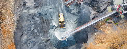
Mining & Quarries
Reducing operational risks, improving supply chain management and enhancing asset life-cycle management are a few examples of the advantages that Bosys can provide using advanced technologies to capture, process and create the necessary products for the Mining & Quarry industry resulting in cost and time saving as well as safety.
services
- 3D Stockpile Models with Accurate Volumes
- Site Survey and Planning
- Pre/Post Blast Inspection
- Improve Mining Site Safety
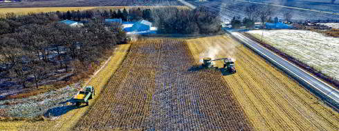
Agriculture & Forestry
Advanced sensor technologies and expert analysis by Bosys provides the agriculture industry with a valuable tool for planning and strategy based on real-time data. The results are deeper crop insights that enable early detection of stress factors, pests and disease, growth state and much more which translates into better yield and reduced costs.
services
- Soil and Field Analysis
- Crop Health Monitoring
- Drainage Planning
- Targeted Input (Water/Pesticides)