GIS | Mapping
advanced spatial products
For over 30 years, the team at Bosys has successfully implemented and managed many Enterprise Geographic Information Systems (GIS) and mapping projects on multiple platforms for the public and private sectors in Canada and around the world.
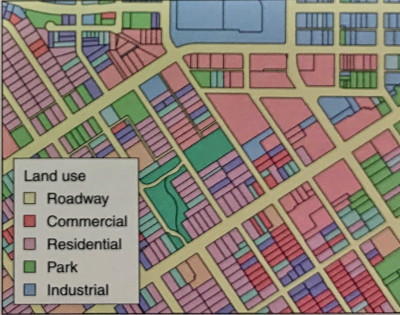
Mapping
From basic static maps to smart and interactive online mapping, our mapping group can create and establish data protocols for automation of data collection and positioning of geo-locatable features or activities that require constant updates on maps accessible from internet connected devices.
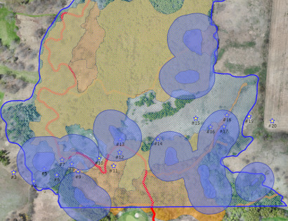
Data Analysis
Spatial data analysis provide timely answers to questions in a simple and intuitive visual spatial interface that integrates data from disparate sources. It is essential in the decision-making process and provides the means to evaluate available options, such as suitability, capability and more, to allow for better predication and forecasting of events, or the consequences of factors affecting a certain location.
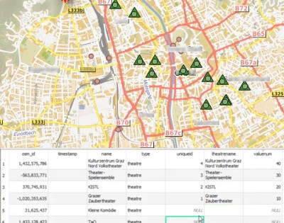
Geocoding
Geocoding is a process used to transform information about a location, such as coordinates, an address, or a name, into a location on a map. By geocoding addresses, for instance, a technician can quickly recognize patterns or discrepancies within the available information or determine best routing or clustering of customers based on certain criteria.
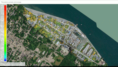
Data Modeling
Data modelling is the process of designing and arranging data in a particular way to best represent geography, business processes and events. GIS data models, such as vector data, raster data and tabular data, are used to visualize information and build scenarios of possible situations to inspect their impact on benefits for a certain area being investigated.