Percision Agriculture
Improving crop yields while reducing cost
Precision Agriculture is a crop management system based on information and technology that analyses the spatial and temporal variability within the field and addresses them systematically to optimize crop health, productivity, and profitability.
Crop Analysis
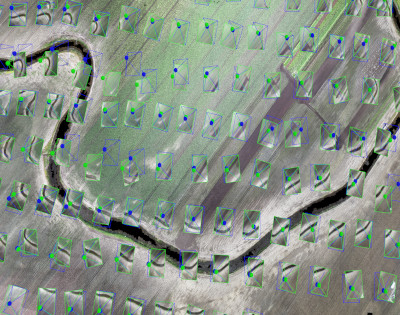
Identifying stress associated with issues like moisture deficiencies, insects, fungal and weed infestations can be detected early giving an opportunity for the farmer to mitigate. Also, crops do not generally grow evenly across the field and consequently crop yield can vary greatly from one spot in the field to another. These growth differences may be a result of soil nutrient deficiencies or other forms of stress. Remote sensing can identify areas within a field which are experiencing difficulties, so that the correct type and amount of fertilizer, pesticide or herbicide can be used.
Crop Monitoring
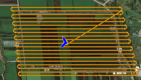
Monitoring crops using remote sensing at the farm level should be done on weekly or semi-monthly basis throughout the growing season and actionable analysis reports provided within a few days of each flight. Contracts can be negotiated depending on the requirements and the size of the farm and will be renewable every year. Bosys works with agronomists to conduct and provide the required analysis and resources.
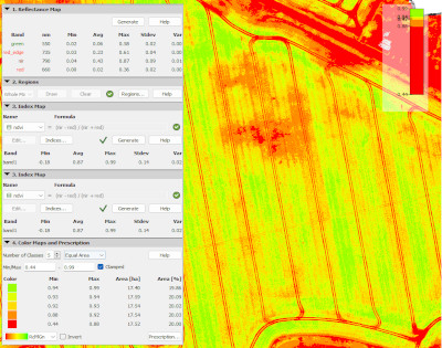
Data Collection
Bosys uses advanced RPAS (drones) and multispectral sensors to remotely collect data and compute the reflectance of the crop which forms the basis for quantifying vegetation condition and identifying areas of damage and crop stress. Data can be provided fully processed or in raw format if the client is equipped to process the data and conduct the required analysis and mitigation.
Data Integration
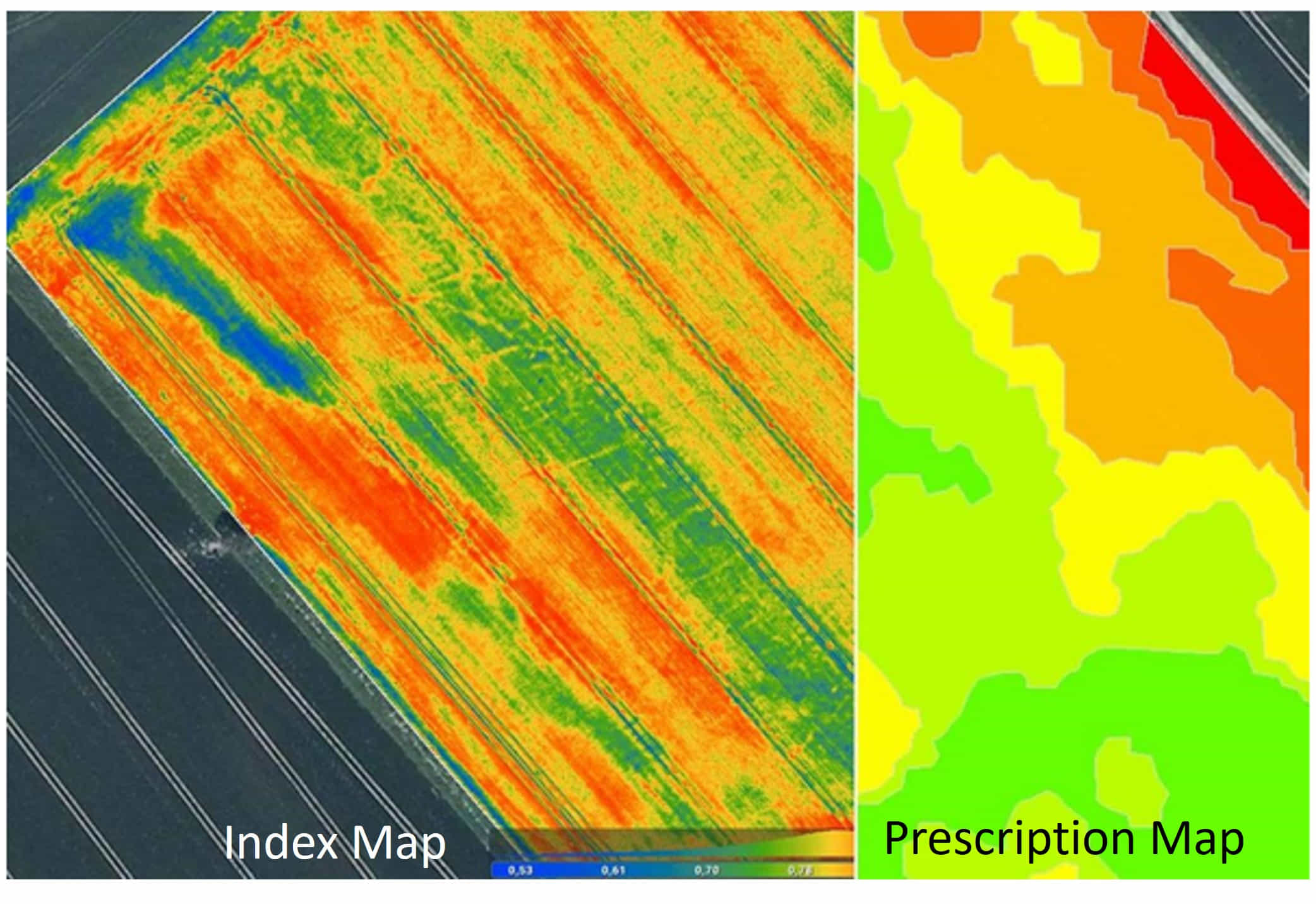
Once data collection, processing and analysis by an agronomist are completed, targeted prescription maps are created based on the requirement of each zone. The maps can then be imported to a smart tractor and used for variable rates fertilizer application to deliver as much or as little nutrition as needed which reduces cost and helps the environment by limiting nutrient run-off into streams and waterways.